
Hobbit forming...

Click to enlarge
Just before Christmas I went to see 'The Hobbit' with my son. I first read this book about 40 years ago, when it was already over 30 years old.
The story is familiar to many I'm sure.
One of the great aspects of Tolkien's writing is the description of the landscape that the characters pass through: particularly the mountains and woodlands. Much has been written elsewhere on this theme, and you should be able to find plenty on the places that provided the inspiration behind Tolkien's work.

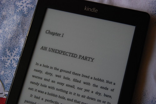
And of course it's now available in different formats. My son and I are currently reading it... on the Kindle.
The landscapes in the film were wonderful. I loved the ruins of Dol Guldur. There were a few bits that I didn't like: the introduction of the new villain, the fighting mountains sequence, and Sylvester McCoy being pulled on a sledge by rabbits for comic relief.Gollum's cave was perfect though...

Comments

Popular posts from this blog

Ideal scenery

Check out this Robert MacFarlane tweet, and the replies that follow for a whole host of ideas on different people's ideal landscapes... Some wonderful images and brief descriptions ideal for sharing... "Tramlines and slagheaps, pieces of machinery, That was, and still is, my ideal scenery." WH Auden Question: what is your "ideal scenery"? pic.twitter.com/8QLS0HRZt9 — Robert Macfarlane (@RobGMacfarlane) July 6, 2017

The path more travelled

I'm currently reading Nicholas Crane's new book on the history of Britain's footpaths: how they came about originally following the drowning of Doggerland , and were then refined by successive waves of change: horses, the Roman invasion etc. It's a dense and scholarly work, with plenty of points of interest and relevance to geographers exploring the connections between people and the landscape. He's taking his book on the road in a series of talks, with three confirmed so far. Here's the description for his talk at Stanford's book shop at the end of the month . He's also speaking in Exeter and Stamford. Walking is a cornerstone of British identity and the most popular form of exercise in the UK. But how much do we know about the paths that we walk? What is their history? Why do they follow the routes that they do? Are they permanent? Can we designate more of them?​ The Path More Travelled is a coast-to-coast history of footpaths from the stone age paths...

Glacier Melt Visualisation

This nice interactive infographic visualises the ice loss from Switzerland's glaciers. It is one of several from the VisQuill site , developed by Dr. Benjamin Niedermann.