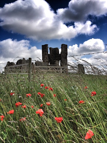
 I spent a pleasant few hours earlier today in the valley of the Gaywood River, just east of King's Lynn with colleagues from UEA and the Norfolk Wildlife Trust. We were involved in testing out an augmented reality solution for allowing visitors to a place to find out more about the nature's benefits / ecosystem services in that area.
Sarah Taigel has created, and is trialling an application called VesAR which stands for Visualising Ecosystem Services using Augmented Reality. It uses an app called LAYAR, which I have previously experimented with.
Holding the phone or tablet up at particular locations reveals 'hotspots' floating in the camera view, which contain more information about what the visitor is looking at. (See the image below)
Ecosystem services are split into three types:
Regulating
Provisioning
Cultural
Essentially, a landscape like the river catchment we walked through provides three types of benefits, e.g. a regulating benefit would be the grazing meadows along the river, which slow down runoff after rainfall and reduce the flood risk, a provisioning benefit would be the nearby Reffley Woods, which provide a source of timber, and a cultural benefit would be the ruin of St. James church (pictured above) which provides a historic reminder of the way in which the landscape was used in the past.
You can perhaps think of other examples of the three types of benefit.
Landscapes are increasingly being managed to protect the existing benefits, and to provide more benefits where possible.
You can read more about the work in this BLOG POST here or on Sarah's website: Communicating Landscape Futures.
Sarah will be presenting at the Enhancing Fieldwork Learning Showcase at Preston Montford in September. I'll be there too presenting the work of Mission:Explore and Guerrilla Geography. The tours that Sarah has been creating will be released to the general public, and be accessible to anyone with an appropriate GPS-enabled smartphone or 3G tablet. I shall let you know when that happens in a future blog post.
Image of St. James ruin: Alan Parkinson
Image of VesAR: Sarah Taigel

Comments